Hello Folks,
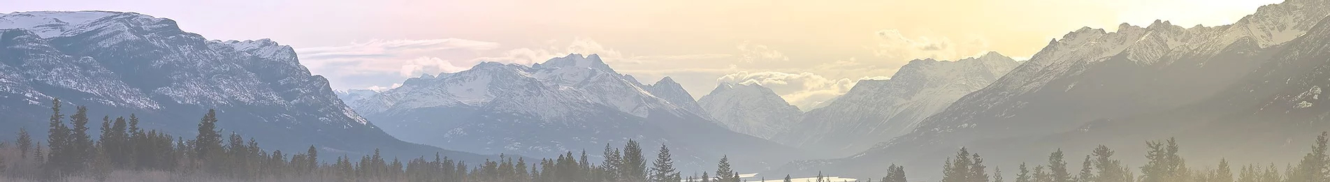
Just returned from a trip to the Lassen BDT. My wife and I are recently retired, so we were excited to begin our overlanding travels with the OTG Lassen Backcountry Discovery Trail. Being new to overlanding we decided to do the trail in sections as shown on the OTG route, but we decided to stay in Chester and Burney hotels for several days with our only camping night being at Manzanita Lake, in the park. We recently purchased a Subaru Outback and added engine and transmission skid plates to compensate for the borderline minimal ground clearance. I realize that puts us in the vehicle minority of most overlanders, but we felt it was the best for our needs. So far, we are very happy with this configuration and found the OTG trail rating to be spot on. We had planned to begin with section one, but when we arrived in Chester we were somewhat overwhelmed by the destruction from the 2021 Dixie fire. We soon realized section one was mostly in the burn area with many roads closed. So, we began our trip in section two with the Ishi Wilderness. This section of the trail turned out to be our favorite. The trail offers a great mix of conditions from rocks, mud holes, fallen trees, gravel, steep climbs and descents, vistas, and a small river crossing. Most were no problem for us, so it would definitely be pretty easy for the Jeep and 4Runner folks. However, I can't stress enough how beautiful the area is no matter what you drive. We hardly passed anyone the whole time except for a couple razors and some forest service people. It took us about six hours to complete this portion, with only a half hour break for lunch at Black Rock campground. We didn't do the Peligreen trail, but what we did travel was in pretty good condition. The forest service does a great job cleaning up fallen trees in most of the sections, and there were a bunch of those! We did have to pay pretty close attention to the Gaia app because the trails aren't marked very well in some spots. Especially, section four--Thousand Lakes--where we went off trail a few times. Section three, the Crossroads was a shorter day and is mostly a ride through forests. The highlight of this day was lunch at Brokeoff Meadows. We found a beautiful spot just across from DP16 which had some old campfire rings and a babbling creek. Also of note was several wildlife sightings--deer, a cat of some kind, and lots of cool birds. The 20 miles of this section took us about 4 hours as expected. Section four, was another mix of landscapes. The trail begins on a graveled forest road and remains mostly that way for about half the trip until you turn off to Latour State Forest. We stopped at Cow Creek campground for a rest and to use the vault toilet, which was pretty decent, before heading on. Shortly after that stop the road got a little dicey. We followed a small 4"x4' sign marked #3, the first LBDT marker we saw, down a little used forest trail that turned out to be riddled with fallen trees. All the trees had been sawn, but most only had minimal openings and several required driving half off the road. This went on for about 10 miles until we emerged into a volcanic, manzanita covered section that led to Cornaz Lake. This lake is now mostly dried up and looks more like a meadow area. From there it took about another 30 minutes along steep open, volcanic, stepped roads, until we emerged onto Hwy 44. That road yeilds a great view of the Hat Creek Rim. From there we took a short drive to the town of Burney and the following day we visited the Burney falls and lake area. We believe any trip to this area should include Burney. Crazy gorgeous!
I hope this encourages some to make this trip. It really was a fun trail and very enjoyable.


