Guest List: Closed
Dates: Thurs May 20 - May 23
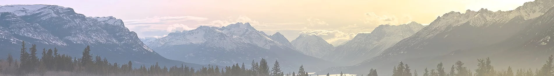
Venue or Route: Lost Coast 4x4 Trail
Recommended Vehicle: Stock 4x4
Fuel Stops: Approx 175 miles between gas stations in Laytonville to Petrolia.
Meeting Location: 12pm on Thursday May 20 @ at the Tesla Supercharger in Laytonville (be sure you top off your fuel tank in town before arriving).
https://goo.gl/maps/wNcygk1Vob5S8mZVA
GPX Files: hidden
Google Map: https://www.google.com/maps/d/u/1/edit?mid=1LpHcXwFOSDZFpF7ZSxNzVqJGzvMxIfon&usp=sharing
The Lost Coast 4x4 Trail is a paid route on OTG. If you'd like the GPX/KMZ files for this route, you'll need to buy a subscription or purchase the route. Recording GPX tracks while on the trail is permitted. The GPX file provide here does not contain all of the route trails or waypoints.
Things to
Know and/or Bring:
- Good vibes and a can do attitude!
- Bring at least $35 cash, including small bills (campsite fees at BLM sites and AW Way County Park/Campground)
- 3+ days of food and water
- Cash for BLM and county campsites (bring at least $35 including small bills)
- Appropriate attire for cooler weather along the coast (nights may dip into the 40s)
- A good pair of hiking boots
-A good camera
- Be prepared to pack out all waste/garbage
- Communications device if you have one (HAM radio freq 146.460)
- Well behaved dogs are welcome! (please leave Fido at home if he/she is aggressive towards people or animals, barks, begs for food)
- Please leave all firearms at home. Using or discharging a firearm is not permitted in CA State Parks or King Range NCA
Daily Itinerary
- Each day will consist of approximately 40-50 miles of mostly dirt roads and some pavement
- Be prepared to be backed and ready to hit the trail between 9:30-10am each day
- Day 1 Camp: Usal Beach, Day 2 Camp: Tolkan Campground, Day 3 Camp: AW Way County Park
Leave No Trace / Tread Lightly
OTG subscribes and supports the principles behind Leave No Trace and Tread Lightly-- better yet, leave it better than you found it! Please come prepared to pack out all of your own waste-- including solid human waste. While Usal Beach does have out houses, they are occasionally locked due to overuse.
Other Things to Know
Overland Trail Guides will be filming throughout the duration of the trip, with the intention of turning the footage into a video route guide for the Lost Coast 4x4 trail. This may entail occasional stops for filming, especially when a drone is used.
Usal Beach / Driving on the Beach is not Permitted
While many camp and drive on the beach at Usal, this is actually not permitted by State Parks. We will be abiding by their regulations and camping in one of the forest campsites, or if we're lucky, we'll see if we can snag one of the sites in the alder trees next to the beach.

Dates: Thurs May 20 - May 23
Venue or Route: Lost Coast 4x4 Trail
Recommended Vehicle: Stock 4x4
Fuel Stops: Approx 175 miles between gas stations in Laytonville to Petrolia.
Meeting Location: 12pm on Thursday May 20 @ at the Tesla Supercharger in Laytonville (be sure you top off your fuel tank in town before arriving).
https://goo.gl/maps/wNcygk1Vob5S8mZVA
GPX Files: hidden
Google Map: https://www.google.com/maps/d/u/1/edit?mid=1LpHcXwFOSDZFpF7ZSxNzVqJGzvMxIfon&usp=sharing
The Lost Coast 4x4 Trail is a paid route on OTG. If you'd like the GPX/KMZ files for this route, you'll need to buy a subscription or purchase the route. Recording GPX tracks while on the trail is permitted. The GPX file provide here does not contain all of the route trails or waypoints.
Things to
Know and/or Bring:
- Good vibes and a can do attitude!
- Bring at least $35 cash, including small bills (campsite fees at BLM sites and AW Way County Park/Campground)
- 3+ days of food and water
- Cash for BLM and county campsites (bring at least $35 including small bills)
- Appropriate attire for cooler weather along the coast (nights may dip into the 40s)
- A good pair of hiking boots
-A good camera
- Be prepared to pack out all waste/garbage
- Communications device if you have one (HAM radio freq 146.460)
- Well behaved dogs are welcome! (please leave Fido at home if he/she is aggressive towards people or animals, barks, begs for food)
- Please leave all firearms at home. Using or discharging a firearm is not permitted in CA State Parks or King Range NCA
Daily Itinerary
- Each day will consist of approximately 40-50 miles of mostly dirt roads and some pavement
- Be prepared to be backed and ready to hit the trail between 9:30-10am each day
- Day 1 Camp: Usal Beach, Day 2 Camp: Tolkan Campground, Day 3 Camp: AW Way County Park
Leave No Trace / Tread Lightly
OTG subscribes and supports the principles behind Leave No Trace and Tread Lightly-- better yet, leave it better than you found it! Please come prepared to pack out all of your own waste-- including solid human waste. While Usal Beach does have out houses, they are occasionally locked due to overuse.
Other Things to Know
Overland Trail Guides will be filming throughout the duration of the trip, with the intention of turning the footage into a video route guide for the Lost Coast 4x4 trail. This may entail occasional stops for filming, especially when a drone is used.
Usal Beach / Driving on the Beach is not Permitted
While many camp and drive on the beach at Usal, this is actually not permitted by State Parks. We will be abiding by their regulations and camping in one of the forest campsites, or if we're lucky, we'll see if we can snag one of the sites in the alder trees next to the beach.
Last edited:
