Dan Hegstad
Trail Grom
- Joined
- Aug 6, 2024
- Messages
- 11
*** You must have a ticket to attend this event ***
San Rafael Swell Adventure Route
April 3 – 8, 2025
250+ miles
Maximum of 6 participants.
GPX File: [coming soon]
Meeting Location:
April 3 @ 9am
We’ll meet on April 3 at 9:00 am at the start of the trail, an unmarked dirt road on Interstate 70 (about 50 feet past mile marker 147 heading west), which is the beginning of Black Dragon Canyon.
This is an excellent route for everyone, from beginners to seasoned. We will travel at a moderate pace, taking time for lunch and exploring.
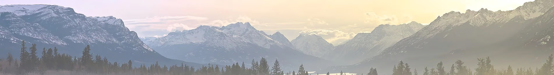
The route is not too difficult, and the scenery is outstanding. Please read the description for a more complete description of the route and trail ratings.
Vehicle: You'll need a high clearance 4x4 (think 4Runner TRD), and even better if you have rock sliders (you may use them!). You should have an appropriate vehicle in good condition, extra fuel, provisions, radio, your camping gear, recovery and safety equipment, and clothing covering a wide variety of weather.
Fuel: There are options for refueling and reprovisioning, although they are off the planned route.
No permits are required.
Pets: Well-behaved dogs are allowed.
Medical Info / Emergency Contact: Please print a copy of pertinent medical info and emergency contact info (at least two persons) on a card/piece of paper and have this attached to your visor.
Comms: GMRS channel 15, freq 462.550
Firearms: This is a family-friendly event. We ask that you leave your firearm at home or keep it stowed away in your vehicle at all times. It is your responsibility to be informed of any local regs pertaining to firearms.
San Rafael Swell Adventure Route
April 3 – 8, 2025
250+ miles
Maximum of 6 participants.
GPX File: [coming soon]
Meeting Location:
April 3 @ 9am
We’ll meet on April 3 at 9:00 am at the start of the trail, an unmarked dirt road on Interstate 70 (about 50 feet past mile marker 147 heading west), which is the beginning of Black Dragon Canyon.
This is an excellent route for everyone, from beginners to seasoned. We will travel at a moderate pace, taking time for lunch and exploring.
The route is not too difficult, and the scenery is outstanding. Please read the description for a more complete description of the route and trail ratings.
Vehicle: You'll need a high clearance 4x4 (think 4Runner TRD), and even better if you have rock sliders (you may use them!). You should have an appropriate vehicle in good condition, extra fuel, provisions, radio, your camping gear, recovery and safety equipment, and clothing covering a wide variety of weather.
Fuel: There are options for refueling and reprovisioning, although they are off the planned route.
No permits are required.
Pets: Well-behaved dogs are allowed.
Medical Info / Emergency Contact: Please print a copy of pertinent medical info and emergency contact info (at least two persons) on a card/piece of paper and have this attached to your visor.
Comms: GMRS channel 15, freq 462.550
Firearms: This is a family-friendly event. We ask that you leave your firearm at home or keep it stowed away in your vehicle at all times. It is your responsibility to be informed of any local regs pertaining to firearms.
Last edited by a moderator:
")
")


