*** You must have a ticket to attend this event ***
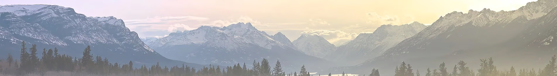
The East Mojave Heritage Trail is a 700+ mile loop consisting of 4 distinct segments through the Mojave National Preserve and surrounding areas. We'll explore segments 2 and 3, and if we wrap up 3, we'll continue along our trip.
Route/GPX: Make sure you download both segments
Meeting Location: Feb 13 @ 9am
Terrible's (gas station) on Yates Well Road along Interstate 15
101620 Yates Well Road
Nipton, CA
Event Ends: head home the morning of Feb 17 (Monday)
Comms: GMRS channel 15 / freq 462.550
Ben's Contact Info: will share via email.
Firewood: Please bring firewood if you can.
Terrain: Sandy washes, lots of dirt roads, and some rockier tracks. Typical trail conditions are usually 2-3 but can reach a 4 in some locations. With the recent flashfloods and atmospheric rivers over the last few years, it's possible some of the trails may have suffered from erosion, and may be impassable. I'll do my best to gather any info on possible trail closures or impassable sections.
Vehicle Requirements:
Wednesday Night Camping: A small group of us will be driving down out of the area and camping in/near Mojave NP the night before the meetupl. Location TBD.
Carry Extra Fuel: Given the uncertainty of conditions from summer flash floods, we're recommending that everyone carry at least 5 gal of extra fuel, and if you can carry more, encourage you to bring this along for other folks who's vehicles may not be equipped to carry extra fuel.
Where Can I find Cheap Fuel?
A quick note about fuel prices, it looks like the "cheapest" fuel can be found in Barstow. Looking at both Google and Gas Buddy, fuel prices in Primm, NV are not nearly as cheap as you might expect, and it looks like fuel is actually cheaper in Barstow. If you're filling up extra rotopax/jerry cans (highly recommended), Barstow looks like your best bet. Fuel prices in Baker appear to be artificially high. The closest fuel location to the meetup spot is in Primm, about 8 minutes east of the meetup location along the Interstate.
Day 1
Mileage: 60-65
Camp: Riggs Cabin vicinity
We'll depart from the meetup lcoation and pick up segment 2 just outside of Primm, NV. We'll climb through the Clark Mountains making our way past ShadowValley and Shadow Mountains that will bring us to the western half of segment 2.
Places we'll see/visit:
Day 2
Mileage: 80
Camp: Bembry Cabin or Vicinity
Fuel: Refuel in Baker
We'll depart from the meetup lcoation and pick up segment 2 just outside of Primm, NV. We'll climb through the Clark Mountains making our way past ShadowValley and Shadow Mountains that will bring us to the western half of segment 2.
Places we'll see/visit:
Day 3
Mileage: 55-60
Camp: Cinder Cone fields
Day three will find us exploring some of the Mojave National Preserve's better known points of interest, like the Mojave Cross and the old Mojave Phone Booth site, which now has a memorial dedicated to the foregone booth. We'll explore the cinder cone fields along with some of the cinder/pumice mines in the area and we'll most likely set up camp in the cinder cone fields, which creates for amazing sunsets and sunrises!
Day 4
Mileage: 70-75
Camp: Somewhere near Mailbox #2 or Amboy, if we can make it to Granite Pass that'd be amazing (but unlikely given miles covered)
Fuel: Refuel in Amboy
coming soon
Additional things to see if we're ahead of schedule
Camp: Circa hole-in-the-wall, but possibly Kelso Dunes or Granite Pass
Our final day on the trail. We'll continue pushing along on segment 3 trying to make our way to hole in the wall. Camp will be determined by how early we wrap up the rings trail. We may camp in the HITW vicinity, or possibly backtrack towards Kelso Dunes or Granite pass depending on what the group decides.
Day 5
Break Camp and Head home!
The East Mojave Heritage Trail is a 700+ mile loop consisting of 4 distinct segments through the Mojave National Preserve and surrounding areas. We'll explore segments 2 and 3, and if we wrap up 3, we'll continue along our trip.
Route/GPX: Make sure you download both segments
Meeting Location: Feb 13 @ 9am
Terrible's (gas station) on Yates Well Road along Interstate 15
101620 Yates Well Road
Nipton, CA
Event Ends: head home the morning of Feb 17 (Monday)
Comms: GMRS channel 15 / freq 462.550
Ben's Contact Info: will share via email.
Firewood: Please bring firewood if you can.
Terrain: Sandy washes, lots of dirt roads, and some rockier tracks. Typical trail conditions are usually 2-3 but can reach a 4 in some locations. With the recent flashfloods and atmospheric rivers over the last few years, it's possible some of the trails may have suffered from erosion, and may be impassable. I'll do my best to gather any info on possible trail closures or impassable sections.
Vehicle Requirements:
- 4x4 with 4-low gearing (no AWD vehicles)
- Aftermarket off road tires (AT, MT, RT) and a full size spare
- Aftermarket lift recommended, but not required
Wednesday Night Camping: A small group of us will be driving down out of the area and camping in/near Mojave NP the night before the meetupl. Location TBD.
Carry Extra Fuel: Given the uncertainty of conditions from summer flash floods, we're recommending that everyone carry at least 5 gal of extra fuel, and if you can carry more, encourage you to bring this along for other folks who's vehicles may not be equipped to carry extra fuel.
Where Can I find Cheap Fuel?
A quick note about fuel prices, it looks like the "cheapest" fuel can be found in Barstow. Looking at both Google and Gas Buddy, fuel prices in Primm, NV are not nearly as cheap as you might expect, and it looks like fuel is actually cheaper in Barstow. If you're filling up extra rotopax/jerry cans (highly recommended), Barstow looks like your best bet. Fuel prices in Baker appear to be artificially high. The closest fuel location to the meetup spot is in Primm, about 8 minutes east of the meetup location along the Interstate.
Day 1
Mileage: 60-65
Camp: Riggs Cabin vicinity
We'll depart from the meetup lcoation and pick up segment 2 just outside of Primm, NV. We'll climb through the Clark Mountains making our way past ShadowValley and Shadow Mountains that will bring us to the western half of segment 2.
Places we'll see/visit:
- Ivanpah Solar Farm
- Coliseum Mine
- Green Cabin
- EMHT Mailbox #2
- Riggs Cabin
- Jake's Cabin
Day 2
Mileage: 80
Camp: Bembry Cabin or Vicinity
Fuel: Refuel in Baker
We'll depart from the meetup lcoation and pick up segment 2 just outside of Primm, NV. We'll climb through the Clark Mountains making our way past ShadowValley and Shadow Mountains that will bring us to the western half of segment 2.
Places we'll see/visit:
- Silver Lake Mine
- Silver Lake cemetery
- Refuel in Baker
- Wanderer Mine and Mine Crack
- Valley Wells Smelter
- Mountain Pass Mine
- Squalor Camp
- New Era Mines & Cabins
Day 3
Mileage: 55-60
Camp: Cinder Cone fields
Day three will find us exploring some of the Mojave National Preserve's better known points of interest, like the Mojave Cross and the old Mojave Phone Booth site, which now has a memorial dedicated to the foregone booth. We'll explore the cinder cone fields along with some of the cinder/pumice mines in the area and we'll most likely set up camp in the cinder cone fields, which creates for amazing sunsets and sunrises!
- Explore New Era Mines and cabins (if we didn't have time the previous day)
- Mojave Cross
- Cow Cove Petroglpyhs (short hike <0.5mi)
- Mojave Phone booth memorial
- Aiken Cinder Cone Mine
- Mojave Lava Tube
- Cinder Cone fields
Day 4
Mileage: 70-75
Camp: Somewhere near Mailbox #2 or Amboy, if we can make it to Granite Pass that'd be amazing (but unlikely given miles covered)
Fuel: Refuel in Amboy
coming soon
- Mojave Megaphone (short 200m scramble up the mountain)
- Broadwell Lake Playa
- EMHT Mailbox #3
- Refuel in Amboy
- Amboy / Roy's Sky Motel
- Hike to Amboy Crater (time permitting - 3mi round trip)
Additional things to see if we're ahead of schedule
Camp: Circa hole-in-the-wall, but possibly Kelso Dunes or Granite Pass
Our final day on the trail. We'll continue pushing along on segment 3 trying to make our way to hole in the wall. Camp will be determined by how early we wrap up the rings trail. We may camp in the HITW vicinity, or possibly backtrack towards Kelso Dunes or Granite pass depending on what the group decides.
- Granite Pass
- Kelso Dunes
- Vulcan Mine
- Hole in the Wall / Rings Trail
- Options if we have more time >> Bonanza King Mine & Providence
- Kelso Train Depot
Day 5
Break Camp and Head home!
Last edited:
